
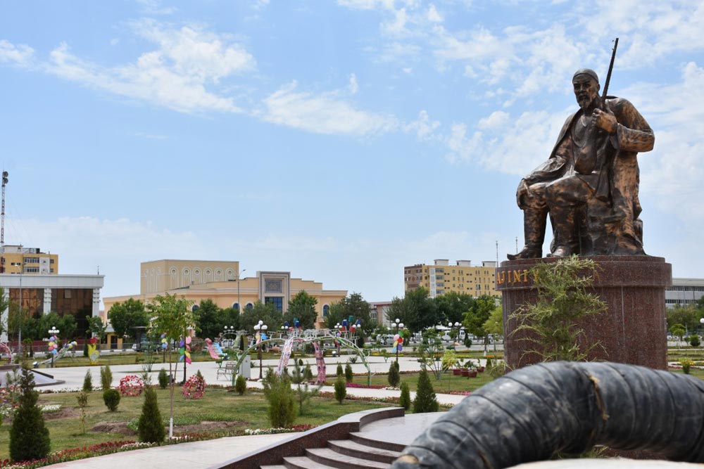
Nukus – The Capital of the Republic of Karakalpakstan
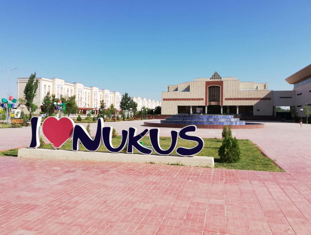
Nukus is the capital of the Autonomous Republic of Karakalpakstan, which forms part of the Republic of Uzbekistan. It serves as the administrative, economic, scientific, and cultural center of the region and is often referred to as the “northern capital” of the country.
Covering an area of more than 200 square kilometers, Nukus is located in northern Uzbekistan, in the southern part of the modern Amu Darya delta, near the well-known shrinking Aral Sea, amid vast sandy expanses. This green oasis is surrounded by three deserts: the Karakum (Black Sands), the Kyzylkum (Red Sands), and the rocky Ustyurt Plateau. In recent decades, a fourth desert has emerged — the “Aralkum” or “Akkum” (“White Sands”), formed from the saline sands of the dried seabed of the Aral Sea.
History of the City
The first settlements in the area of present-day Nukus date back to the 4th–3rd centuries BCE. Archaeologists have discovered the ancient settlement of Shurcha (4th century BCE – 4th century CE), which once served as a stronghold of ancient Khorezm.
The name Nukus (or Nokis) is also the collective name of a Karakalpak clan. In historical literature, this name appears relatively infrequently. According to some researchers, the word “Nokis” derives from the Persian root “Nukus,” meaning “nine persons.” This raises the question of how the term evolved into the name of a tribe. To understand this, one may refer to a well-known folk legend.
According to legend, a Shah of the Khorezm state once became angered with nine court maidens and forbade them from communicating with men or marrying. He ordered them to be exiled to a place uninhabited by people. They were sent to the territory of present-day Khojeyli, which at that time had no permanent population. The maidens settled near a trade route used by merchant caravans. In time, several merchants secretly became acquainted with the exiled women. Eventually, the maidens became mothers and gave birth to nine sons, who later grew into valiant warriors. After defending their lands against enemies and returning victorious from battle, they became known as “Nukes” (“nine persons” — toguz batyr). In time, they were regarded as the founders of the Karakalpak clan known as “Nokis.”
Population of Nukus
Nukus has a population of approximately 260,000 residents. The city is characterized by a diverse ethnic composition, including Karakalpaks, Uzbeks, Turkmens, Kazakhs, Russians, Koreans, and representatives of other nationalities.
The Karakalpaks are the indigenous population of the Republic of Karakalpakstan. They also reside in the Fergana and Khorezm regions of Uzbekistan, as well as in Turkmenistan, Kazakhstan, and Afghanistan. The Karakalpak language belongs to the Turkic language family. The majority of Karakalpaks practice Sunni Islam.
Among the most ancient ancestors of the Karakalpaks were the Saka-Massagetae tribes, who lived along the southern shores of the Aral Sea between the 7th and 2nd centuries BCE.
Between the 6th and 8th centuries, the local population assimilated with Turkic tribes. From the 8th to the 10th centuries, the formation of the Karakalpak people began within the environment of the Pecheneg and Oghuz tribes. Over time, a portion of the Pechenegs intermixed with the Kipchaks who migrated from the Irtysh River basin, gradually adopting their language.
In the 17th and 18th centuries, the Karakalpaks inhabited the middle and lower reaches of the Syr Darya River. By 1811, they came under the authority of the Khiva Khanate and were resettled to the Amu Darya delta. In 1873, the territory inhabited by the Karakalpaks on the right bank of the Amu Darya became part of the Russian Empire.
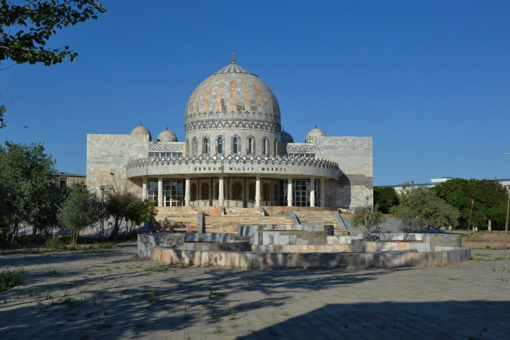
Berdakh Museum
In 1997, in commemoration of the 170th anniversary of the great Karakalpak poet and thinker Berdakh, a decision was made to establish a museum in his honor. In 1998, a dedicated museum building was constructed at Karakalpak State University.
The museum building, with a total area of 1.26 thousand square meters, is a three-story structure crowned with one large dome and six smaller domes. The architectural design was created by Orynbay Toreniyazov, a distinguished architect of the republic and laureate of the Berdakh State Prize. With its distinctive architectural appearance, the museum has become one of the city’s notable landmarks.
As a treasury of cultural heritage, the museum reflects the historical path of the people from ancient times to the present day. The Berdakh Museum fully embodies this mission, serving as both a cultural and educational center.
Scholars regard Berdakh as the first historian of the Karakalpak people. His work “Shezhire” represents a true genealogy not only of the Karakalpaks but also contains valuable information about Turkic peoples as a whole. The text mentions approximately 300 historical figures who played significant roles in the region’s past. Among his literary works are poems dedicated to national heroes, including “Amangeldi” and “Ernazar Biy,” whose images remain preserved in the collective memory of the people.
In addition to his poetic talent, Berdakh was also a gifted bakhshi (traditional epic storyteller and musician) and was widely respected not only among the Karakalpaks but also among neighboring peoples, including the Uzbeks of Khorezm and the Turkmen.
The museum’s exhibitions present the history, ethnography, and culture of the Karakalpak people. Plans include the organization of specialized thematic halls devoted to archaeology, ethnography, art, and history. Particular interest among visitors is drawn to the Manuscripts Hall, where written monuments in Arabic, Persian, and Turkic languages that have survived to the present day are carefully preserved.
In the future, the museum aims to become a regional center for the restoration, conservation, and study of written heritage in Karakalpakstan, thereby expanding its scientific and educational role.
Through its exhibitions, visitors gain insight into the development of education in Karakalpakstan, including materials related to historical and contemporary religious institutions such as madrasahs and mektebs, the first Soviet educational establishments, and the formation of secondary and higher education in the region.
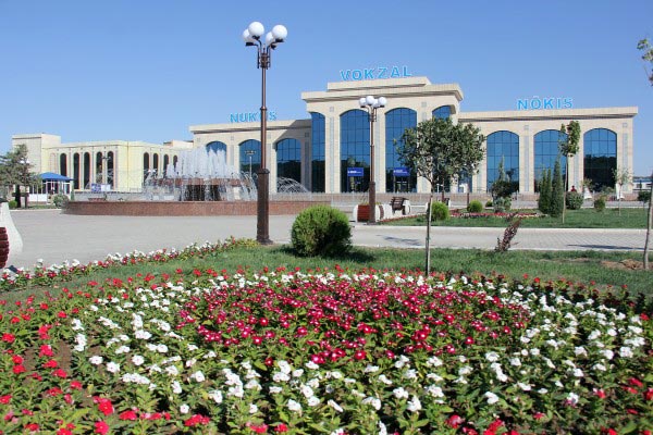
Karakalpakstan State Museum of Local History, Nukus
The Karakalpakstan State Museum of Local History is one of the oldest scientific and educational institutions not only in the lower reaches of the Amu Darya and the Aral Sea region, but also in Central Asia as a whole. In 2009, the museum marked its 80th anniversary.
According to archival records, the museum was established in 1929 in Turtkul, the former capital of the republic. Its first exhibition opened to the public on May 16 of the same year.
Today, the museum is one of the most renowned cultural institutions in the region. While its collection initially comprised only a few dozen items, it now includes more than 56,000 exhibits.
The museum’s collections are expanded annually through acquisitions, regional expeditions, and archaeological excavations. Close cooperation has been established with the Karakalpak Branch of the Academy of Sciences of the Republic of Uzbekistan, Karakalpak State University, as well as schools and colleges. Together, they continue efforts to acquire works of traditional applied arts and to create new exhibitions dedicated to contemporary Karakalpakstan. The museum also hosts a wide range of events, including commemorative evenings, anniversaries, meetings, seminars, exhibitions, museum lessons, lectures, and practical sessions for university students.
Each department of the museum is distinctive and rich in content. The natural history halls are especially popular among children. Carefully designed displays transport visitors to vast степpe landscapes and soaring skies. Dioramas such as “Ustyurt,” “Kyzylkum,” “Aral Sea,” “Waterfowl,” and “Tugai Forests” vividly present the flora and fauna characteristic of the republic.
The Department of Archaeology offers an engaging introduction to the ancient history of the region. The territory of Karakalpakstan contains approximately 200 archaeological sites, including the remains of ancient settlements. Scale models of Toprak-Kala and Koykrylgan-Kala, along with household items and tools, provide insight into the lives of early inhabitants and the passage of centuries. Of particular interest is a marble capital dating to the 5th–4th centuries BCE, discovered in the Sultan Uvays Dag Mountains in the Beruniy district.
The exhibition of traditional applied arts is among the most striking sections of the museum. It presents masterpieces created by skilled artisans, reflecting a living tradition of craftsmanship. Intricate embroidery, weaving, jewelry, and various handicrafts demonstrate remarkable artistry and originality. Traditional embroidered garments and items such as kok koilek, zhegde, shaykalta, shynycap, shanash, and kiyimeshek are displayed alongside woven carpets and yurt decorations, including kergi, karshin, korzhin, ak baskur, kyzyl kur, janbau, ayakbau, and various types of palas rugs, all of which reflect centuries-old traditions.
The jewelry collection features finely crafted pieces such as haikel, onirmonshak, ayshik, tuyme, arebek, as well as earrings, bracelets, and rings adorned with carnelian, turquoise, and coral. Traditional musical instruments—including the dutar, kobyz, shynkobyz, syrnai, and balaman—remain integral to performing arts today.
One of the most valuable exhibits illustrating the daily life and ethnography of the Karakalpak people is the yurt. Distinguished by its rich decoration and refined craftsmanship, the Karakalpak yurt differs significantly from the traditional dwellings of other peoples.
The Department of Modern History highlights the republic’s achievements during the years of independence.
The museum serves as a unique center of aesthetic education and a true temple of history. Its staff are dedicated to preserving the heritage of past generations, carefully safeguarding each exhibit for the benefit of future generations. As the saying goes, without the past there is no future—and the doors of this temple of history are open to all.
Savitsky State Museum of Arts
Few museums in the republic can rival the Nukus-based I. V. Savitsky State Museum of Arts in terms of the uniqueness of its collection of Russian paintings and its international reputation. The museum is named after Igor Vitalyevich Savitsky, a Moscow-born artist whose dedication and vision laid the foundation for its extraordinary holdings.
Igor Savitsky arrived in Nukus in the 1950s and, in 1966, was appointed Director of the Nukus Museum. This appointment enabled him to begin systematically acquiring works of art. Initially devoted to archaeological research and the ethnography of the Karakalpak people, Savitsky soon developed a deep interest in collecting modern art—much of which, under the prevailing political regime, was officially prohibited.
At considerable personal risk, and facing the possibility of being labeled an “enemy of the people,” Savitsky assembled a collection of banned works by artists who were later recognized as representatives of the avant-garde. As a result of his efforts, the museum’s collection grew to include approximately 50,000 works from the Soviet avant-garde and post-avant-garde periods. In Nukus—far removed from the official cultural centers of the time—visitors were able to view works that had been suppressed in the USSR for many years.
Today, the Savitsky Museum’s collection exceeds 90,000 items. It includes an outstanding collection of Russian avant-garde art, fine art of Uzbekistan, traditional applied art of Karakalpakstan, and artifacts from Ancient Khorezm, complemented by high-quality replicas of selected masterpieces from the Louvre in Paris. Even such renowned institutions as the Russian Museum in St. Petersburg and the Tretyakov Gallery in Moscow acknowledge the exceptional significance of the Nukus collection.
According to art experts and international media, the State Museum of the Republic of Karakalpakstan named after I. V. Savitsky houses the finest art collection in the Asian region and possesses the world’s second most important and extensive collection of Russian avant-garde works.
The British newspaper The Guardian described it as “one of the finest museums in the world.” Similar praise—“one of the best museums in the world”—has been expressed by prominent international figures such as Albert Gore and Jacques Chirac. The museum’s collections have been admired by former and current ambassadors of leading world powers, including the United Kingdom, France, Germany, and Japan, as well as by cultural advisers and attachés, representatives of UNESCO, and officials from the United States.
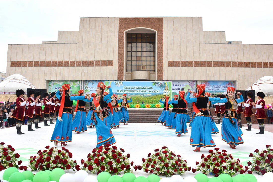
Monuments to Berdakh, Ulugbek, and Ajiniyaz
Much can be learned about the culture and life of a people not only by visiting well-known tourist landmarks, but also by observing the monuments erected in their cities. Monuments reflect whom the people honor, whom they regard as ideals, and who has played a significant role in their history. They serve as a testament to the values and historical memory of the nation.
Monument to Berdakh
Berdakh holds a place of special reverence among the people of Karakalpakstan. He was an active advocate for the rights of his people and became a national hero. In addition to his civic stance, Berdakh is widely known for his literary legacy. His patriotic poetry inspired faith and resilience, encouraging people to believe in their strength and in the necessity of defending their rights.
Monument to Ulugbek
Ulugbek, the grandson of the renowned Central Asian conqueror Amir Temur (Tamerlane), was a distinguished ruler and an outstanding scholar. During his reign, special emphasis was placed on the development of science and culture. Ulugbek himself conducted significant scientific research, particularly in astronomy, and his intellectual achievements continue to command deep respect among the people of the region.
Monument to Ajiniyaz
Ajiniyaz is a prominent poet of the Karakalpak people. His poetry is imbued with patriotism and humanism, reflecting profound devotion to his homeland and its people. In Nukus, one of the city’s central squares bears his name, and it is there that the monument dedicated to him is located.
Mizdahkan Necropolis
The Mizdahkan Necropolis is an archaeological and architectural complex dating from the 4th century BCE to the 14th century CE, with origins tracing back at least 2,000 years. It is one of the most significant historical sites in Karakalpakstan.
Among its notable features are the so-called “World Clock” structures. These are brick buildings that, according to legend, lose one brick each year. It is said that when the structure finally collapses completely, the end of the world will come. Currently, the building is about one-third ruined. According to ancient tradition, if seven bricks are arranged into a pyramid and a wish is made, it will be fulfilled, as the number seven is considered sacred in Islam.
The archaeological complex of Ancient Mizdahkan spans over 200 hectares and is located along major historical trade routes leading to Kunya-Urgench (Turkmenistan) and the northern districts of the Republic of Karakalpakstan, including Kungrad and Muynak, as well as the Ustyurt Plateau.
The main sections of the complex are situated on three hills on the southwestern outskirts of the town of Khodjeyli. These include the Gyaur-Kala fortress, the mausoleums of Shamun Nabi, Mazlumkhan Sulu, Khalfa Yerezhep, and the caravanserai. Excavations have revealed unique burial assemblages, coins, household items, glassware, and finely crafted gold artifacts, reflecting the high level of craftsmanship and rich material culture of the region.
Mausoleum of Shamun Nabi
The seven-domed Mausoleum of Shamun Nabi is located on the northern hill of the Mizdahkan complex. The structure is dated to the 18th century. Inside the mausoleum lies a tomb measuring over 25 meters in length. According to one version of local legend, Shamun Nabi was a giant, which corresponds to the size of his tomb; another version portrays him as a magician and miracle worker. He was said to understand the language of animals, heal illnesses, control natural elements, and even influence the movement of celestial bodies. There is no reliable information about his religious affiliation.
The tomb itself is a variant of the widely known Central Asian funerary structure called a sakhana. The Shamun Nabi sakhana is housed within the seven-domed mausoleum, constructed from both sun-dried and fired bricks of various sizes.
The sakhana is a narrow structure measuring 25 × 31 cm in length, 1.29 m in width, and 1.07 m in height. At its base are two steps that run along its perimeter. Along almost the entire length of the tomb’s top, a rectangular layer of fired bricks is laid.
Almost all sacred objects in Mizdahkan are associated with the number seven. The seven domes of the Shamun Nabi mausoleum correspond to the number of his daughters. This symbolism may also be connected with the ritual of stacking seven stones into small pyramids at the necropolis. Visitors who create these pyramids typically make wishes for healing or the fulfillment of cherished desires. It is believed that these requests are addressed directly to Shamun Nabi.
In July 1966, an expedition of archaeologists, ethnographers, paleontologists, and anthropologists opened the tomb to investigate the reason for such a large burial site. No human remains were found, though locals say that the mystic “did not allow himself to be discovered.” Despite this, people continue to visit the mausoleum daily to seek help from Shamun Nabi, with some returning to offer thanks for wishes granted.
Today, the mausoleum is actively visited by believers, especially on Wednesdays. Visitors range in age from young children to the elderly. Many seek relief from illness, infertile women pray for children, and elderly pilgrims ask the saint for well-being in the afterlife. The mausoleum continues to serve as a powerful spiritual and cultural site for the local community.
Janbas-Kala Settlement
The Janbas-Kala settlement dates back to the ancient period of Khorezm’s history, known as the era of the “thousand cities” in the region. This period is divided into two phases: the Kangju phase and the Kushan phase, named after the states to which Khorezm belonged. The founding of Janbas-Kala fortress belongs to the first, Kangju, phase. The fortress’s construction has been dated by archaeologist S. P. Tolstov to the 4th century BCE – 1st century CE.
Janbas-Kala is the most north-eastern fortress among the “lands of ancient irrigation.” It is situated on the north-western slope of a flat desert plateau, extending from northwest to southeast, forming the final link in a chain of hills stretching southeast from the Sultan-Uizdag Mountains.
The fortress has a clearly defined rectangular layout, oriented along the cardinal directions, measuring approximately 200 × 170 meters. Its relative preservation is largely due to centuries of sand accumulation from nearby dunes, which protected the exterior walls. The walls of Janbas-Kala reach almost 10 meters in height, underscoring the scale of the structure. Behind the main exterior wall lies a secondary, reinforcing wall, which strengthened the fortress’s defenses. The outer wall tapers downward, with a top width of 1.3 meters, while the inner wall is about 1 meter wide. Narrow embrasures in the outer wall further confirm its military purpose.
A distinctive feature of Janbas-Kala’s architecture, setting it apart from other fortresses of the period, is the complete absence of corner towers—a rarity in Eastern fortifications. Another notable feature is the preserved pre-gate structure, which allowed defenders to funnel attackers into a narrow corridor leading to the gate, enabling them to target enemies through the embrasures.
The internal layout of the fortress is relatively simple. From the northwest gate, the main (and likely only) street ran southeast to a large building near the southern gate. Residential quarters flanked both sides of the street, with each quarter divided into approximately 150 rooms.
The building near the southern gate is believed by archaeologists to have been a fire-worship sanctuary, known as the “House of Fire.” It was situated on a raised platform, approximately 4.5 meters high. Archaeological evidence supporting this theory includes ashes found in the corner room of the sanctuary.
For several centuries, the residents of Janbas-Kala successfully defended the fortress against nomadic raids. However, in the 1st century CE, after a failed attempt to storm the cleverly designed gates, invaders breached the wall slightly west of the entrance using a battering ram. A battle ensued inside, as indicated by discovered arrowheads. It is likely that most of the inhabitants were killed, and survivors were taken into slavery. Following this event, the fortress was not restored and gradually succumbed to rain and wind over the next 2,000 years. Today, only the massive walls remain as a testament to Janbas-Kala’s former grandeur.
Jumart Kassab
Jumart Kassab is a mound-like hill approximately 5 meters high, located near the Mausoleum of Shamun Nabi. On its summit and slopes, remnants of fired-brick structures and fragments of Khorezmian ceramics can be observed, suggesting that the mound conceals ancient constructions beneath its surface.
The site is associated with a local legend of Jumart, a kind-hearted butcher who distributed meat freely to the poor during years of famine. For his selfless generosity and compassion, he was venerated as a saint.
The mound serves as a pilgrimage site (ziyarat) for childless women. The ritual is performed as follows: pilgrims climb the mound after first seeking permission from the guardians of the mausoleum (shiikhshi). They circle the sakhana, touching it with their hands, and then descend the hill while performing seven ritual turns, accompanied by a spiritual chant (maksym).
It is believed that this sacred site may be directly connected to ancient Zoroastrian ideas about Gayomard—the first human created by Ahura Mazda, the God of Wisdom and the Sun. According to the Zoroastrian sacred text, the Avesta, the city of Mazda was constructed in honor of Ahura Mazda, where the first human was created. Interestingly, the Uzbek word for “human,” adam, preserves this original meaning.
Some interpretations suggest that the Garden of Paradise described in Zoroastrianism—a flourishing orchard enclosed by clay walls—may have been envisioned in this very region of Khorezm. Even the legendary “forbidden apple” resonates linguistically in Uzbek: olma means “apple,” but it also contains a verbal negation (ol = “take,” ma = “do not”), symbolizing the divine command: “Do not take!”
Jumart Kassab thus represents both a physical and spiritual landmark, linking historical, legendary, and religious traditions of the region.
Janpyk-Kala Fortress
Janpyk-Kala Fortress is located just 6 km from the Urgench–Nukus highway (50 km from Nukus) on the southwestern slopes of the Sultan-Uizdag Range, near the banks of the Amu Darya River and at the edge of the Badai-Tugay Reserve.
The renowned Soviet archaeologist S. P. Tolstov, who led the Khorezm Archaeological and Ethnographic Expedition in Karakalpakstan, described Janpyk-Kala as the most beautiful fortress in Khorezm. The fortress is especially striking when viewed from the southeast at sunset. After a long forested road, the mountains suddenly emerge, and framed by trees and rocks, the dark green walls and towers of the fortress appear against the glowing sky, creating an almost magical landscape.
The earliest structures within the fortress date back to ancient times (4th century BCE – 1st century CE). However, the walls visible today belong to the medieval period and were constructed between the 9th and 10th centuries CE. Inside the fortress are residential and industrial zones, dating from the 12th–14th centuries CE. On the northwest side, there is a palace or citadel with walls adorned with elegant stucco decorations, characteristic of medieval Khorezm architecture.
The layout of the settlement is irregular, following the natural contours of the terrain. Atop the fortifications once stood an open gallery for archers, protected at the front by a low wall. Access to the gallery was provided by steps built into the wall. Five towers have survived to the present day, spaced approximately 70 meters apart. Only one tower on the eastern wall contains an internal chamber; the others are solid structures.
It is believed that the fortress originally had two entrances: one on the northern wall leading to a cemetery, and another along a bend in the southern wall. At the highest point of the settlement lies a rectangular citadel. Evidence of a breach can still be seen on the southern wall, caused during the Mongol invasion.
Janpyk-Kala stands as an outstanding example of Khorezmian fortress architecture, combining military functionality with aesthetic appeal and bearing witness to centuries of history.
Chilpyk Fortress
The ring-shaped structure of Chilpyk is located along the highway, 43 km south of Nukus (towards Khiva, Samarkand, Tashkent) atop a conical hill 35–40 meters high.
This ancient Zoroastrian monument—the Chilpyk Dakhma (also known as Shylpyk or Chilpyk-Kala)—is over 2,200 years old. Chilpyk is a circular, roofless tower, 15 meters in height and 65 meters in diameter, situated on a naturally rounded hill. It was used by Zoroastrians as a site for sky burials, where the deceased were left for consumption by birds of prey. Later, the bones were collected in clay ossuaries and buried in the ground. This burial method reflected the Zoroastrian philosophy, which forbade contaminating the earth with decaying bodies.
Originally, a 20-meter staircase carved into the hill led to the tower. From the base, a passage extended toward the river. Around and within the tower, clay and stone ossuaries have been discovered, some of which are now displayed in museums in Nukus and Tashkent. The Dakhma was constructed between the 2nd and 4th centuries CE, and during the 9th–11th centuries, it was repurposed by local inhabitants as a watchtower.
Following the arrival of the Arabs in the 7th century, the tower underwent reconstruction and was again renovated in the 9th–10th centuries during the height of Ancient Khorezm. Some researchers believe that the Khorezmians used Chilpyk as both a defensive and signal tower, alongside other fortresses of the Khorezmshah state. Chilpyk is one of Karakalpakstan’s most striking landmarks, so much so that its image appears on the republic’s emblem.
Visitors are advised to explore Chilpyk early in the morning before the sun becomes intense. From the fortress, one can enjoy a panoramic view: the full-flowing Amu Darya sparkles in the sunlight, bordered by lush fields and gardens, while nearby lies the sun-dried wasteland, dotted with green and reddish shrubs and salt flats. At the site’s highest point, a tripod marks the summit, adorned with strips of fabric tied by locals for luck and good fortune.
Ayaz-Kala Settlement
The Ayaz-Kala fortress is located 20 km northeast of Toprak-Kala, the ancient capital of Khorezm, between the shifting sands of the Kyzylkum Desert and the foothills of the sacred Sultan-Uizdag mountains. The choice of this site by its unknown builders is impressive: perched on a flat hill composed of marble-like limestone, the fortress was nearly impregnable. Its southern, western, and northern sides are protected by steep slopes, while an elevated plateau on the eastern side presented a formidable obstacle even for lightly armed travelers, let alone soldiers.
The double walls of Ayaz-Kala, oriented along the cardinal directions and made of sun-dried bricks, enclose an area of about 3 hectares. The outer wall, still standing at 10 meters high, is roughly 2.5 meters thick, while the inner wall is slightly narrower. Semi-circular towers, spaced 11–13 meters apart, reinforce the walls. Each tower contains a spacious interior, likely intended for resting guards or soldiers during battles.
A covered corridor runs along the perimeter between the walls, topped with a vaulted ceiling. Above this corridor was a firing gallery with narrow slanted loopholes. The fortress has a single entrance on the south side, protected by a clever pre-gate labyrinth. The dominant southern winds naturally swept dust and debris out of the fortress, which is why its name—Ayaz-Kala—can be translated as “Fortress in the Wind.”
Archaeologists date the fortress to the 4th century BCE based on the brickwork and masonry techniques. A bronze three-bladed arrowhead found near the southern wall of the pre-gate labyrinth confirms this era. These arrows were typical of the Sarmatians and Saka, nomadic tribes who roamed the lower Syr Darya region and often threatened the cities of Ancient Khorezm.
Several legends surround Ayaz-Kala. One tells of a time of great unrest when the old ruler died without an heir. Priests prophesied that the new king would be chosen by a royal hunting falcon: it landed not on a hand but on the head of an ordinary soldier. When the falcon flew away and returned, the people accepted the soldier as their new ruler, who then oversaw the construction of the fortress and ruled justly for many years. To honor his origins, he hung an old worn boot in a visible place before his throne.
In the early centuries CE, the inhabitants attempted to strengthen the fortress further. Bricks were prepared, and new towers began construction on the western and southern sides of the outer wall. Archaeologists have discovered stacks of bricks laid vertically “on edge.” Why this construction was never completed and why the fortress and its garrison were abandoned remains a mystery for future researchers.
Kyzyl-Kala Fortress
Kyzyl-Kala is located in Ancient Khorezm (modern Karakalpakstan), very close to the ancient settlement of Toprak-Kala. According to some sources, Kyzyl-Kala was part of Toprak-Kala’s defensive system, serving as an auxiliary fortress.
The fortress represents the final stage of architectural development in Ancient Khorezm and is considered a prototype of the massive columned fortresses of the Afrighid period. It was discovered during the Khorezm Expedition led by S.P. Tolstov in 1938, with most of the research conducted by expedition members.
Kyzyl-Kala is relatively small and almost square in shape. Excavations of the foundations revealed that the fortress was surrounded by double walls with watchtowers at the corners. A main street ran through the center of the settlement, ending at a fire-worship temple where Zoroastrian priests conducted rituals. The residential area was divided by the street into several blocks, each containing multiple rooms where families lived.
This fortress is a unique architectural monument of the Kushano-Afrighid period in Ancient Khorezm. Standing alone on the plain, it acted as a guardian for Toprak-Kala, the “pearl” of Ancient Khorezm. Legend has it that an underground passage once connected Toprak-Kala and Kyzyl-Kala, which is plausible given Kyzyl-Kala’s defensive function. The fortress remained in use until the Mongol invasion, forming part of the defensive system of the Khorezmshah state.
Urga – Abandoned Fishing Village
In the mid-20th century, the village of Urga thrived on the shore of Lake Sudochye, with several hundred residents. It was one of the first Russian settlements in Karakalpakstan. The last resident left in 1971, yet the village continues to “live” as a tourist destination. Visitors come here to fish and enjoy the sight of flamingos on the lake.
In May 2014, ornithologists discovered a colony of 7,000 greater flamingos near this location, representing 1.4% of the global population.
Koy-Krylgan-Kala Archaeological Site
To the northeast of the city of Turtkul in Karakalpakstan lie the ruins of the remarkable Koy-Krylgan-Kala settlement (4th century BCE), a significant site associated with funerary and astral cults of ancient Khorezm, and one of the main Zoroastrian monuments in Uzbekistan.
Archaeological findings indicate that Koy-Krylgan-Kala functioned as a temple-tomb complex, where astronomical observations and certain ritual ceremonies were conducted. It should be noted that Zoroastrianism dominated the Khorezm region during this period. Even during the site’s later decline, when only artisans remained, the location continued to be considered sacred, and ossuaries containing the remains of the deceased were brought here.
The name Koy-Krylgan-Kala translates as “Fortress of the Slain Sheep.” It is one of the few fully excavated ancient structures with an original layout. The ruins of the once-mighty fortress are circular at the base. Excavations revealed a rich collection of ancient artworks, including alabaster and terracotta figurines, ceramic urns and ossuaries, stone seals, ceramic flasks, fragments of wall paintings, and monuments inscribed in the Avestan script—the earliest writing system in Central Asia.
Originally, Koy-Krylgan-Kala was a two-story circular structure approximately 45 meters in diameter, surrounded by a deep moat. The main temple was enclosed by two walls, located 15 meters from the central building, with a gallery for archers.
The ground floor of the main building contained eight vaulted chambers for ritual ceremonies, forming two isolated complexes. Each complex had its own entrance via a staircase from the archery gallery. The second floor, with a flat ceiling, included a covered gallery with arrow slits. Upper rooms housed temple artifacts and terracotta statues of deities. Within the fortress were also residential quarters and storage facilities.
Koy-Krylgan-Kala was distinguished by the grandeur of its constructions, a sophisticated defensive system, and the presence of storerooms, where large food supplies were stored in granaries and underground pits.
Toprak-Kala Archaeological Site
Toprak-Kala is one of the outstanding cultural monuments of Khorezm, dating from the 1st to 6th centuries CE. In the 3rd century, it served as the capital of Khorezm. The site was discovered by the Khorezm expedition led by S.P. Tolstov in 1938.
The city was laid out in a precise rectangular plan. In the northwest corner stood the ruler’s palace—a massive three-towered fortress. To the southeast of the palace was a fire temple. From the temple, a long street extended southwards, dividing the city into two halves. Side streets branched off, separating the large residential quarters that composed the capital of late Khorezm’s slave-owning society. The fortress, constructed in the 3rd century, served as the residence of the Khorezmshah rulers until 305 CE. Due to numerous military invasions, the rulers eventually abandoned the palace, and the city gradually fell into decline.
Archaeological excavations at Toprak-Kala uncovered coins, fragments of ossuaries (Zoroastrian funerary vessels), and exquisite examples of ancient Khorezmian artistic culture. Finds included finely crafted ceramics, woolen and silk textiles, gold jewelry, and a necklace of 300 beads made from glass, paste, amber, coral, and shells. Workshops for the production of the famous Khorezm bows were also discovered. The site’s architecture represents a remarkable example of urban planning and fortification in ancient Khorezm, particularly the three-towered ruler’s palace. Each of the three monumental towers, containing residential rooms inside, originally reached 30 meters in height; today, they rise to approximately 25 meters, reflecting the advanced level of Khorezmian architecture.
Toprak-Kala is notable not only for its striking architecture but also for the unique discoveries of ancient Khorezmian written documents. Archival records were found in four rooms in the southeast section of the palace. A total of 116 documents, written in black ink on wooden tablets and leather scrolls, were uncovered. Eighteen wooden documents are exceptionally well preserved. Although the texts have not yet been fully deciphered, their purpose is clear: they were administrative records of the palace. Three of the documents carry precise dates: 207, 231, and 232 CE.
In addition to the archive, the palace yielded sculptures and wall paintings of extraordinary significance. For this reason, Toprak-Kala is often referred to as the “Museum of Fine Arts of Ancient Khorezm.” As the only fully excavated architectural monument in the region, its scale and ingenious design make Toprak-Kala one of the most unique and important heritage sites of Khorezm.
Gyaur-Kala Archaeological Site
Atop the flat western hill of the historical and archaeological complex of Mizdakhan, near the city of Khodjeyli in Karakalpakstan, rise the imposing ruins of the ancient settlement of Gyaur-Kala. The colossal ten-meter-high fortress walls, encircling the steep slopes of the hill, remain impressive to this day. Inside the walls, the intricate labyrinths of two citadels from different periods are visible. The earlier citadel features defensive towers, which some archaeologists believe may have served not only as fortifications but also as temple structures. Excavations in the other citadel revealed a large central courtyard surrounded by ceremonial, residential, and utility buildings adorned with painted and carved clay decorations. Towards the Mizdakhan necropolis stands a collapsed section of a monumental arch that once adorned the city gates. Throughout the site, numerous mounds mark the locations of ancient structures.
The outline of Gyaur-Kala is barely visible to the untrained eye, but Uzbek scholars have established that as early as the 4th century BCE, the hills of Mizdakhan were home to the city of Mazda—a major commercial and craft center of the Khorezm state, through which one of the northern branches of the Great Silk Road passed. This is evidenced by finds such as fabric fragments with gold threads, cowrie shells from the Indian Ocean, and coral beads.
The Russian archaeologist and orientalist S. Tolstov, who studied the ruins of Khorezm for several decades, concluded that one of the world’s oldest religions—Zoroastrianism—originated in this region and spread throughout Asia. Many scholars support the view that it was here, near Khodjeyli, that Zoroaster himself composed the first Gathas—hymns of the sacred book, the Avesta. There is no doubt that the city was inhabited by fire-worshippers, followers of Zoroastrianism.
In 712 CE, Arab forces under the command of Qutayba ibn Muslim invaded Khorezm. The city’s population resisted for seventy years, and it was during this period that the site acquired its current name: Gyaur-Kala, meaning “Fortress of the Infidels,” as the Muslims considered the Zoroastrian fire-worshippers to be pagans.
Archaeologists have determined that the cultural layer of Gyaur-Kala reaches ten meters and spans the period from the 4th century BCE to the early 13th century CE. Over time, local traditions merged with the Islamic faith. However, the Mongol invasions brought unprecedented devastation: in 1220, the forces of Jochi, son of Genghis Khan, destroyed the city completely.
In the lowlands nearby, among the sands, the layout of a later settlement from the 13th–14th centuries can still be traced. After the Mongol invasion, residents of Gyaur-Kala resettled here, establishing what became known locally as Shakhar-Antakhiya. Excavations revealed residential buildings, artisan workshops producing ceramic and metal items, oil presses, and wine cellars. In one quarter, a mosque (namazgokh) was uncovered, complete with a sophisticated drainage system constructed from large ceramic pipes, reflecting the advanced engineering skills of the inhabitants. Yet even this city eventually succumbed to the encroaching sands.
Gyaur-Kala remains the highest hill in the region. Its clay slopes have never been used for grazing or cultivation. From the citadel walls, the surrounding steppe stretches for tens of kilometers. For eight centuries, the ruins of Gyaur-Kala have stood as a lasting reminder of the prosperity of ancient Khorezm.
Mausoleum of Mazlumkhan Sulu
The Mausoleum of Mazlumkhan Sulu is shrouded in one of the most romantic legends of the region. It is said that the master who built the mausoleum and completed work beneath its dome proposed to the daughter of a high-ranking official for whom he was working. The proud and beautiful girl declared that she would only love him if he leapt from the height. Without hesitation, the master jumped and tragically died on the stone floor. Overcome with grief, the girl immediately took her own life. Subsequent burials were later made at the site.
The architectural history of the mausoleum is equally fascinating. Initially, between the 12th and 14th centuries, an underground complex of rooms was constructed. In the niches of the main hall, two burials were performed. Later, the mausoleum’s portal was destroyed, and an above-ground group of chambers was built, where a series of burials took place in both the large and small halls of the underground section.
Scholars describe the interior layout as follows: the central hall is square, with three deep and one shallow niches. The western wall opens through an arch to a smaller hall, covered by an octagonal dome lined with blue-glazed bricks. The northern wall features a deep niche, while the western and southern walls contain shallow niches. On the north side of the large hall, two dark chambers with “Balkhi” vaults are attached. In both rooms, the transition to the domes is executed using stalactite-like structures made from carved terracotta blocks. Exquisite floral motifs, coated with a delicate blue glaze, harmonize beautifully with the pinkish-yellow terracotta background. The walls and arches are adorned with brickwork decorated with carved blue glazed “ribbons.”
Russian scholar A. Nekrasov, in his work published in Notes of the Orientalists’ Collegium at the Central Asian Museum of the Academy of Sciences of the Former USSR, documents inscriptions found on the gravestones at Mazlumkhan Sulu. Translated freely, some read:
“Neither joy nor sorrow will stay aside,
There will be both celebration and grief,
The flute will sound, wine will be drunk,
Friends and loved ones will not remain,
Illnesses and their cures will vanish,
Pleasure will not exist, the body shall not delight,
No one will save you from the iron claws of death—
These are two chains, tightly bound.”
Another inscription reads:
“Look upon my state,
See my condition, yet do not bring misfortune,
When my body turns to ash,
Pray for me in some way,
Life is beautiful, alas, it is not eternal.”
In recent years, based on local legends, a poetic drama has been created in Karakalpak literature, telling the story of a young man named Nazlym and a girl called Kansulu (or perhaps Khansulu). However, it is traditionally considered inappropriate to name male children Nazlym among the local population. Considering that the girl buried in the mausoleum came from an aristocratic family, the name Nazlymkhan is likely unreliable.
The name Mazlumkhan Sulu (or Mazlum Khansulu) reflects the spirit of the legend more faithfully. In Persian, mazlum means “suffering” or “oppressed,” while Khansulu refers to the girl’s name or is an epithet related to her.