
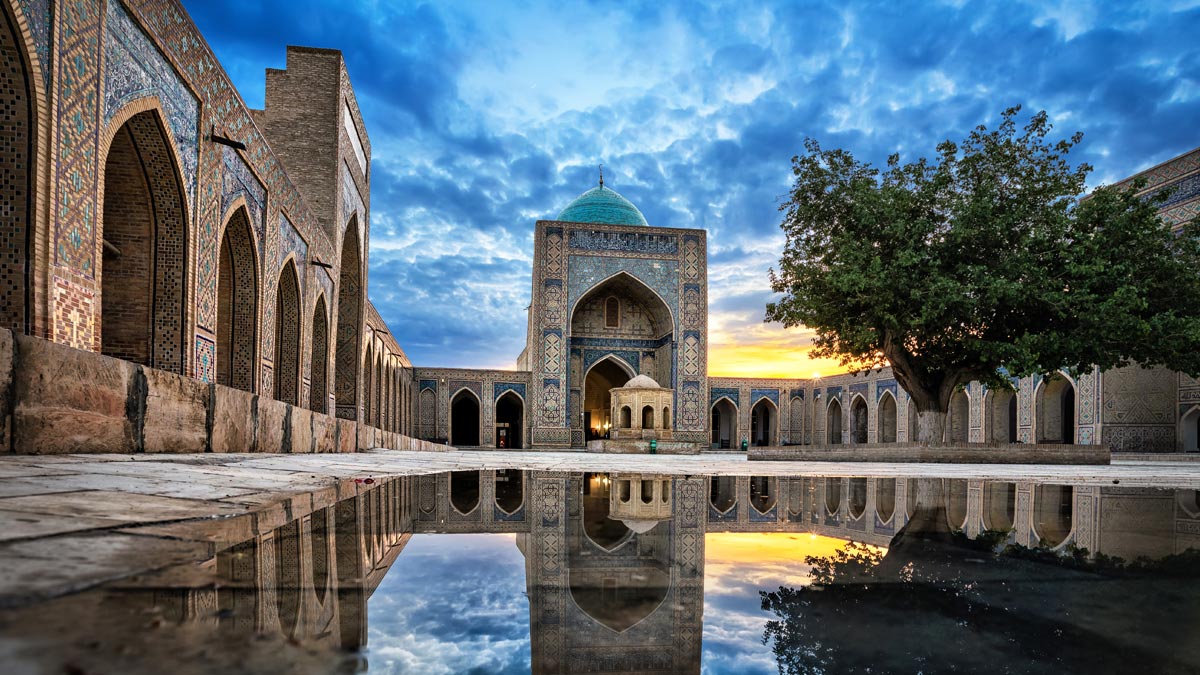
Surkhandarya
The southernmost region of Uzbekistan, Surkhandarya, has long attracted the attention of archaeologists from around the world. In particular, the city of Termez, which is surrounded by numerous ancient historical monuments, stands out. The globally renowned mausoleum of Al-Khakim al-Termezi, the Buddhist settlements Karatepa and Fayaztepa, and the memorial-religious complex Sultan Saodat have been extensively studied not only by Uzbek scholars but also by their international colleagues.
History
On April 2, 2002, Termez celebrated its 2,500th anniversary. It is one of the oldest cities in the world, having existed in the mid-1st millennium BCE on the banks of the Oxus (Amu Darya) River.
According to the descriptions of Hofizi Abruy, the name of the city originates from the word “Taramastha” meaning “a place on the other bank.” Throughout history, the city has been known by various names, including Darmit, Antiochia, Demetrias, Tarmita, Tarmid, Tarmiz, Tami, and Tamo, only acquiring its modern name in the 10th century.
The city has repeatedly fallen to conquerors, only to rise again from its ashes. Its period of greatest prosperity is considered to be during the reign of the Kushan Empire (105–250 CE). The Kushan era left a significant mark on world culture. At that time, Termez was regarded as one of the largest centers of Buddhism, from which the religion spread to China, the Far East, Korea, and Japan.
Within Old Termez, many Buddhist monuments have been preserved, including the Zurmala Stupa, the Karatepa temple complex, the Fayaztepa monastery, and others.
Based on surviving fragments of visual and applied arts from ancient and medieval Termez, the city can confidently be regarded as a historical center of artistic culture for the entire Central Asian region. The chess pieces made of ivory discovered at Dalverzintepa, dating back to the 2nd century BCE, are among the oldest in the world.
Throughout different periods, Termez was part of the Ghaznavid, Karakhanid, Karakhtay, Seljuk, and Khwarezmian states.
In the early medieval period, Termez functioned as an independent domain, encompassing the city and its surrounding territories. Before the advent of Islam, the rulers of Termez bore the title of “Termezshah”, the last of whom reigned in the second half of the 7th century.
Between the 10th and 12th centuries, Termez emerged as a prosperous and significant center of crafts and trade in Tokharistan. The city was famous for its large bazaar and fortress on the bank of the Jayhun (Amu Darya) River. By that time, the city’s area exceeded 500 hectares.
The Sultan Saodat Mausoleum Ensemble
The Sultan Saodat Mausoleum Ensemble, whose name translates as “King of Happiness,” represents the family burial site of Termez rulers – the Sayyids – and includes the remains of cult buildings dating from the 13th–14th centuries.
The entire complex is constructed of brick and, apart from the main façade, has no exterior cladding. Despite this simplicity, the buildings possess remarkable beauty.
The surviving group of mausoleums, built at different times from baked bricks, forms a long courtyard along their principal façades. On the western end of the main axis stands the oldest mausoleum, while on the eastern end rises a monumental Darvaza-Khana (main entrance – no longer preserved). Across the road from the Darvaza-Khana was the Khanaka, and to the west were the raw-brick buildings of the Chilla-Khana.
The original core of the ensemble is a unique structure consisting of two vaulted rooms connected by an arched iwan. The side walls of the iwan feature entrances to the northern chamber, Gur-Khana (mausoleum), and the southern chamber, Ziyarat-Khana.
Constructed from baked brick, the complex demonstrates the extraordinary skill of its ancient builders. The carefully laid brickwork includes decorative patterns such as paired herringbone bricks, bows, diamonds, rings, and floral motifs, accented with bands of dressed bricks. The square walls support an octagonal tier of arched squinches, upon which large domes are set. The ensemble exhibits a strikingly strict and highly artistic appearance, reflecting architectural features unique to Termez.
Most of the original decoration has been lost, but research has helped reconstruct the former appearance of the complex, which included majolica cladding, gilded surfaces, and wall paintings executed in black and blue. Pilgrims have long been drawn to the site to light candles and lamps, so repeated repairs by custodians over the centuries have nearly erased the original ornamentation. Time has also taken its toll – khanakas were repurposed as kitchens or sheep pens, and underground movements damaged the bricks.
Today, the complex has been fully restored. It stands as a solemn, silent monument, remarkable for its architectural perfection and harmonious completeness.
Zurmala Stupa
Among the archaeological monuments of Surkhandarya Region, the Zurmala Stupa (or Zurmala Tower) is particularly well-known. It is located southeast of the Old Termez settlement, along the roadside leading to the regional center. The ruins of the tower have long attracted the attention of archaeologists. As early as 1926, it was suggested that the structure was a Buddhist stupa. Detailed surveys conducted half a century later confirmed that this was indeed a religious structure dating back to the peak of the Kushan Empire.
Although the tower has suffered significant damage over time, it still makes a powerful impression. Constructed from square sun-dried bricks approximately 33 cm per side, each brick bears a characteristic mark consisting of a line and two indentations. Archaeologists note that such bricks were used in Bactria only during the Kushan period, in the early 3rd century CE, before being replaced by rectangular bricks. It is estimated that nearly 1,200,000 bricks were used to build the stupa. The solid brick structure contains a small chamber for relics at its upper section.
The stupa stands on a platform measuring 22 by 16 meters, oriented according to the cardinal directions. Its cylindrical body, 14.5 meters in diameter, rises 13 meters above the base, with a clear transition from the brickwork to the hemispherical top. Archaeological investigations have shown that the platform was originally faced with marl limestone. At the base of the stupa, several stone blocks and profiled moldings were discovered. Researchers also found fragments of fired bricks around the stupa, indicating that baked bricks were used for cladding. It remains unclear whether the stupa was part of a larger, now-lost temple complex or a freestanding monument.
The stupa represents one of the most important and ancient Buddhist symbols. Early stupas, including the Zurmala Tower, were constructed from bricks and stones in the form of hemispheres. Their design drew inspiration from ancient burial mounds (kurgans) and symbolized Parinirvana—the death and burial of the Buddha. The term stupa in Sanskrit literally means “a heap of earth or stones.”
Stupas were built on a base that allowed circumambulation, and they served as repositories for Buddhist relics. In the centuries following the Buddha’s death, relics such as strands of his hair, fragments of his robes, or portions of his incorrupt remains were placed in a cubic reliquary known as the “divine house.” Later, precious metals, gemstones, and symbolic grains were also stored as relics. The reliquary was placed at the stupa’s summit, above which rose a central shaft topped with progressively smaller umbrellas.
The umbrella, symbolizing noble origin, was widely recognized in India. Siddhartha Gautama, the founder of Buddhism and the “Enlightened One,” was the son of a prince in northeastern India. Since the Buddha was regarded not only as a spiritual teacher but also as a sovereign of the gods and the universe, stupas commemorating him were crowned with multiple umbrellas. Over time, this ancient funerary symbol evolved in Southeast Asia into the architectural form of the pagoda, or stupa, crowned with a spire.
Karatepa
The Buddhist cult center of Karatepa (translated from Uzbek as “Black Hill”) occupies an area of approximately 7 hectares and is situated on a three-part sandstone elevation that once hosted dozens of monastic and temple complexes. The center consisted of a complex of independent structures, including rock-cut and above-ground buildings (on the western and southern summits of Karatepa) as well as entirely above-ground constructions (on the northern summit).
The rock-cut and above-ground buildings combined structures made of sun-dried bricks on terraces carved into the hillsides with caves hewn directly from sandstone. Archaeologists have discovered staircases in the above-ground sections, indicating the presence of second floors.
Epigraphic evidence, found in inscriptions on ceramics in various contexts, repeatedly mentions the term “vihara” – meaning monastery. Scholars therefore conclude that the rock-cut and above-ground structures at Karatepa functioned as Buddhist monasteries.
Stupas at Karatepa were constructed from clay, faced with stone, and decorated on top with images of the Buddha, humans, animals, and sacred symbols. This method of stupa construction was widely used throughout Central Asia, a region rich in clay but poor in stone and wood. Clay was also used for sculptures depicting the Buddha, his disciples, and devotees, while stone carvings were rare. The few fragments discovered suggest that Karatepa also featured stone sculptures of the Buddha.
The temples and monasteries preserved a unique representation of the Buddha. At Karatepa, a fragment of a wall painting remains, executed in tempera on a clay base, depicting the Buddha seated in the dhyana pose wearing a red robe. Though the fresco is partially eroded, its harmony and beauty remain perceptible. Emerging almost from semi-oblivion, the calm and gentle visage of the Buddha conveys a sense of salvation and triumph over a world consumed by fire.
Teshik-Tash Cave
The Teshik-Tash Cave (literally “Pierced Stone”), renowned worldwide, is located at an altitude of approximately 1,500 meters in the Baysuntau Mountains, on a pass in the northern part of Surkhandarya Region.
In 1938–1939, archaeologist Aleksei Pavlovich Okladnikov made a sensational discovery at the site: a prehistoric Mousterian culture camp and a burial containing the remains of an 8–9-year-old Neanderthal child. The grave was surrounded by the horns of mountain goats embedded in the ground, suggesting the possible existence of religious or ritual practices among Neanderthals.
During these early excavations, alongside the child’s skeletal remains, archaeologists uncovered bones of various animals. This evidence indicates that the burial was not a simple interment but part of a complex ritualistic ceremony. Initially, the skeleton was believed to be male; however, further detailed analysis revealed that the remains belonged to a girl under 10 years old.
Today, the Termez Museum displays a sculptural reconstruction of the child’s appearance, created based on anthropological studies. Since its discovery, Teshik-Tash Cave has become one of the most significant and popular tourist destinations for visitors from around the world.
Sapallitepa and Jarkutan – Ancient Bactrian Settlements
In the Surkhandarya Region of Uzbekistan, near the southernmost city of Termez, the remains of the ancient settlement of Jarkutan have survived to this day. This city was once one of the central centers of Bactria, a powerful and developed state located on the territory of modern Uzbekistan. Nearby, archaeologists have also uncovered traces of an even older settlement, often referred to as the proto-city of Sapallitepa.
Both Jarkutan and Sapallitepa date back to a period before the emergence of Islam, Christianity, or even Zoroastrianism. The inhabitants of these lands were fire-worshippers, as evidenced by the buildings and ritual objects discovered on site.
At Sapallitepa, visitors can observe well-preserved remnants of ancient walls, which housed settled communities engaged in continuous conflicts with adversaries. The city was heavily fortified, illustrating the successful transition of local nomads from constant migration to a settled way of life. Standing among these ruins, tourists experience an extraordinary sense of antiquity, conveyed through the stillness, the spirit of the past, and the breathtaking panorama of the ancient settlement.
Historically, most scholars agree that the city was founded at the turn of the 2nd–1st millennium BCE, making it truly ancient. Jarkutan, a contemporary of Sapallitepa, achieved more progressive development. Its strategic location along ancient trade routes allowed foreign visitors to introduce new cultural practices, including the gradual establishment of patriarchy, which replaced the previously matriarchal social structure.
Jarkutan was a city of craftsmen, where potters and sculptors produced numerous figurines and household items, many of which were traded with passing nomads. Its wealth and developed material culture made it a target for ancient raiders, resulting in frequent attacks. However, these challenges spurred further urban development, and the city was well-fortified for its time.
These ancient Bactrian cities laid the foundations of future statehood and religion. The progress of settled life and the emergence of active trade led to social stratification, forming the basis for organized civilization. Moreover, the local fire-worship practices later evolved into the powerful religion known as Zoroastrianism.
Kara-Kamar Cave
This historical and cultural complex is unique not only for its architectural or historical features but also for its location. Kara-Kamar, which is over 2,000 years old, was literally carved into the mountain rock on the border between Turkmenistan and Uzbekistan.
Archaeologists have uncovered numerous unique artifacts at the site.
The complex first came to the attention of scholars in 1857, when the well-known researcher and ethnographer N. Maev was surveying certain Bukhara roads. Today, it is recognized that the overall layout of the mountain chambers is truly unique; nowhere else in the East can a structure resembling Kara-Kamar be found. Researchers have identified the following spaces within the complex:
- Three spacious halls
- Rooms for clergy and worshippers
- A rectangular courtyard, measuring over 200 square meters with a height of ten meters
The interior of the complex is rich with written inscriptions in multiple languages, including:
- Greek
- Arabic
- Latin – the discovery of Latin texts was a major scientific sensation. Considering that Kara-Kamar is located thousands of kilometers from Ancient Rome, where Latin was used, the finding of a tablet containing a 300-line Latin inscription significantly challenged existing scholarly concepts. The Latin texts mention Gaius Rex and the name of a Roman legion, “Apollinaris”, as well as references to Bactria and other historical elements.
Architectural Monuments of Termez
“History is the treasury of our deeds, the witness of the past, an example and lesson for the present, and a warning for the future.”
In the southernmost region of Uzbekistan lies the remarkable city of Sherabad, with a population of approximately 25,000 according to the 2004 census. The city is situated on the banks of the Sherabad River, about 60 kilometers from Termez in the Surkhandarya Region. The lands of Surkhandarya preserve numerous secrets and are considered the cradle of our ancestors.
Every year, Sherabad attracts the attention of archaeologists from around the world. Over the past twenty years, active archaeological excavations in the region have revealed the lives of ancient civilizations that once thrived in this territory.
The lands of Sherabad encompass a significant portion of Central Asian history, beginning with the Bronze Age (3rd–early 1st millennium BCE). In southern Uzbekistan, three local centers of the Bronze Age have been identified, all located on the banks of the Sherabad River. Among them, the settlements of Jarkutan and Sapallitepa stand out as local centers, giving rise to ancient Bactria.
In the mountainous areas of Surkhandarya, archaeological research conducted between 1931 and 1948 uncovered a cave containing ancient human remains. Among the discoveries were the remains of an 8-year-old boy and the skeleton of an adult Neanderthal, excavated in 1938. These remains date to the Middle Paleolithic period (150,000–30,000 years ago), indicating that the history of human habitation in southern Uzbekistan extends deep into the distant past.
In addition, around 3,000 stone tools and a large number of animal bones—belonging to mountain goats, deer, wild horses, leopards, hares, and birds—were discovered in the mountainous regions.
Sherabad remains rich in historical monuments. The city is home to the famous 9th-century mausoleum of Abu Isa Muhammad at-Tirmidhi, a Muslim scholar, author of numerous works on various aspects of Islamic teachings, and compiler of the Hadith collection “Sunan at-Tirmidhi.”
The southern region of Uzbekistan is extraordinarily rich in archaeological and historical sites. Its past spans a vast fragment of Uzbekistan’s history, offering invaluable insights into the ancient civilizations and cultural heritage of the region.
Memorial Complex of Al-Hakim at-Tirmidhi
The Memorial Complex of Al-Hakim at-Tirmidhi is situated on an extensive area enclosed by a brick wall.
Abu Abdullah Muhammad ibn Ali ibn al-Husayn at-Tirmidhi, also known as Al-Hakim at-Tirmidhi (c. 755–869, Termez), was a prominent representative of East Iranian Sufism and the author of approximately eighty works. He earned the honorary title Al-Hakim (the Wise) for the depth of his knowledge and the breadth of his intellectual vision.
At-Tirmidhi was born in Termez. From the age of eight, he diligently pursued religious studies, and at twenty-eight he traveled to Mecca. Upon returning from the Hajj, he studied Sufism under renowned Sufi masters of the time, including Abu Turab an-Nakhshabi, Yahya al-Jalla, and Ahmad ibn Khadrawayhi. His wife also played a significant role in his life, sharing and supporting his spiritual pursuits.
Among his notable students were Abu Ali al-Juzjani and Abu Bakr al-Warraq, who made important contributions to the continuation of his teachings. Some of At-Tirmidhi’s ideas were later adopted by the famous Sufi thinker Ibn Arabi.
In his sermons and writings, such as “Ilal al-Shari’a” and “Khatm al-Awliya”, At-Tirmidhi reflected on the meaning of Islamic rituals, the concept of divine love, mystical categories, and the notion of the “Seal of the Saints”, which he placed alongside the “Seal of the Prophets”. By elevating saints (awliya) to a status comparable with prophets, At-Tirmidhi faced opposition from Islamic jurists (fuqaha) and political authorities. As a result, he temporarily relocated to Balkh and then Nishapur, where he gained numerous followers. He later returned to Termez, where he passed away.
At-Tirmidhi’s works explore the soul, its states, and its movements. He developed teachings on self-perfection and the control of the nafs (instincts), as well as the concept of suffering as purification from sin, which greatly influenced later Sufi psychology. He was one of the first scholars to provide a theoretical foundation for Sufi conceptions of saints (awliya).
According to At-Tirmidhi, the highest attainable human knowledge is mariifa (gnosis), which he identified with the Divine Light (nur) residing in human hearts. Unlike ordinary knowledge (ilm), which is limited to interpreting and applying Islamic law (sharia), mariifa enables understanding of the hidden essence of things and, ultimately, the Divine Reality itself.
At-Tirmidhi maintained that mariifa is a boundless grace bestowed by God upon the spiritually elect. It cannot be acquired through conventional learning but is accessible to Sufi saints (awliya) whose souls are purified of worldly attachments and whose thoughts are fully directed toward God. For ordinary believers, mariifa remains inaccessible.
The 1,000-Year-Old Plane Tree in Sairob
In the village of Sairob in the Surkhandarya Region, there grows an extraordinary ancient plane tree (Chinar). The tree reaches a height of 26 meters, and according to legend, it is approximately 1,000 years old. Its massive, rough trunk, with a circumference of 20 spans, firmly anchors the tree to the ground, while its roots extend deep into the earth.
The plane tree is renowned not only for its venerable age. The trunk is hollow, forming a cavity resembling a small cylindrical room, with an entrance framed by wooden doors.
Originally, this hollow served as a school, accommodating about 20 students and a teacher inside. Later, between 1932 and 1934, the space was used as a library.
Today, the local community carefully preserves this ancient tree. Visitors have the opportunity to explore the historic interior of the tree and learn fascinating stories about its long and remarkable history.
Bolaliktepa Settlement
The Bolaliktepa Settlement, dating back to the 5th–6th centuries, is located 30 km north of Termez. Its name derives from the fact that the site consists of a large and a small mound.
Access to the brick fortress was provided by a suspension bridge, and each room was equipped with special openings for archers. Later, three additional rooms were added for ceremonial purposes, with a brick hearth constructed at the center. Archaeological excavations have uncovered musical instruments, pottery made of clay and glass, a chillum, and other artifacts.
Particularly noteworthy are the wall paintings, which adorn all four walls of one of the rooms. The paintings, created with adhesive-based pigments over clay-coated walls, depict a ceremonial reception of guests.
In the foreground of the compositions, men and women dressed in traditional attire and ornaments are shown seated in a circle. The women’s long hair is tied in knots and secured with white bands. Behind them, servants holding fans can be seen standing.
Kampyrtepa Settlement
The preserved part of the Kampyrtepa fortress covers an area of approximately 4 hectares. The settlement consists of a citadel surrounded by a moat and a “lower town” enclosed by a defensive wall with towers.
Researchers have determined that Kampyrtepa, located on the ancient Burdakuy crossing, functioned as a guesthouse and customs post, established to service the crossing over the Oxus River (Amu Darya). The port facilitated the transport of various goods traveling along the route from Afrasiab to India.
In 2004, the Bactrian team of the Central Asian Archaeological Expedition of the Institute of Archaeology began excavations in the eastern part of the lower town. Previously, it was believed that the entire lower town, which contained residential quarters built according to a unified plan in the early Kushan period (1st century CE), had no earlier construction. However, during the first excavation season, archaeologists uncovered three additional building phases beneath the Kushan layers: Early Hellenistic, Greco-Bactrian, and Kushan-Yuezhi.
The study of Kampyrtepa has yielded numerous unique discoveries in the material and artistic culture of Kushan Bactria. A particularly remarkable find was the ruins of a Buddhist sanctuary, within which a terracotta sculpture of a seated Buddha dating to the first half of the 2nd century CE was discovered at the base of one wall.
Unique conservation efforts have been undertaken at Kampyrtepa. Using ancient construction techniques, parts of the external fortress wall and a Kushan residential quarter have been restored. Loess, sourced from the foot of the fortress wall, was dried on-site and laid with clay mortar to form mud bricks.
The Kampyrtepa fortress is listed among UNESCO-protected cultural heritage sites.
Dalverzintepa Settlement
The Dalverzintepa settlement is located in the Shurchinsky district of Surkhandarya Region, in the fertile valley of the Surkhandarya River. Its origins date back to the 3rd century BCE, with its peak during the Kushan Empire (1st–4th centuries CE), and its decline occurring in the 4th–5th centuries CE.
At the height of its development, the city was surrounded by a defensive wall approximately 2.5 km long, up to 10 meters thick, and accompanied by a wide moat. The city walls and towers contained arrow galleries and casemates, while the battlements were equipped with walkways and platforms for archers, slingers, and stone-throwing devices.
The Kushan Empire reached its zenith under King Kanishka I, attaining such political stability, economic strength, and cultural sophistication that it could compete with the three other major Eurasian superpowers of antiquity — the Roman Empire, the Parthian Empire, and the Han Dynasty of China. These four great powers extended their influence from the Atlantic Ocean to the Pacific Ocean. Historians later referred to the period of 1st–4th centuries CE as the “imperial era.” During this time, the Great Silk Road, the largest caravan route in human history, stretched from China through Kushan and Parthian lands to Roman Syria.
One of the most remarkable achievements of the Kushan period was the high level of culture, which combined the heritage of local ancient Eastern civilizations, the best traditions of Hellenistic culture, the refinement of Indian art, and a distinctive style introduced by nomadic tribes from across Asia.
A key factor in this prosperity was the policy of interethnic and interfaith tolerance pursued by Emperor Kanishka. Foreign merchants and pilgrims traveled along the Kushan Empire with ease, as the state provided a favorable and secure environment for peaceful coexistence, regardless of ethnicity or spiritual orientation. During this period, Buddhism flourished and spread along the Silk Road to Eastern Turkestan, China, and later to the Korean Peninsula and Japan.
Archaeologically, Dalverzintepa represents a nearly “pristine” ancient city, providing a unique opportunity to study urban planning, fortifications, architecture, art, and material culture of Northern Bactria, particularly during the era of the Great Kushans.
Artifacts from Dalverzintepa have been exhibited internationally in Japan, Switzerland, Germany, France, the USA, Malaysia, and South Korea.
Ayritam Settlement
The Ayritam settlement is an ancient site featuring a number of important historical monuments. It is located along one of the banks of the Amu Darya River, nearly 20 kilometers from Termez. The studied area of the settlement, where a fort operated in the 2nd century, covers almost 90 hectares.
From the 1st century CE, a Buddhist community began to develop here, marking the start of active construction of religious and cult buildings. The peak of Buddhist culture in the region occurred during the Kushan era, when the temple complex was completed. Historical records suggest that its length reached nearly 3,000 meters.
Architects and artisans of the time ensured that the complex was truly magnificent:
- Numerous sculptures adorned the buildings;
- Construction used baked bricks;
- A well-developed production and service system supported the complex;
- There was a dedicated brick kiln;
- A pottery workshop operated on site.
However, this grandeur lasted only until the beginning of the 3rd century CE. The economic and cultural decline of the settlement was so severe that the city never fully recovered.
Jarkurgan Minaret
In the village of Minor, Jarkurgan District, located 60 km from Termez, stands a majestic minaret that once belonged to a large congregational mosque, now in ruins. The minaret was constructed in 503 AH (1110 CE) by the architect Ali, son of Muhammad from Serakhs, as indicated by an inscription on one of its ribs. Both the minaret and the mosque were built by the order of Emir Sultan Sanjar.
The foundation of the structure is made of baked bricks and measures 5.4 meters in diameter. Rising above it is the base of the minaret, pierced with pointed arches. Each side of the base is adorned with a square niche containing Kufic inscriptions.
The shaft of the minaret, 21.6 meters tall, is fluted and composed of 16 connected semi-columns, topped with a decorative band of epigraphic ornamentation.
Originally, the minaret was taller, featuring a second tier and topped with a traditional domed lantern, but during difficult years, the upper part of the minaret and the mosque ruins were dismantled by locals for bricks.
Even today, despite the loss of its original height and a 2-meter lean from vertical, the minaret remains a remarkable architectural monument, admired for its beauty and proportions.
Kirk-Kiz Women’s Monastery
Surkhandarya has long attracted archaeologists from around the world. Particularly, the ancient city of Termez, around which numerous historical monuments are concentrated. Just a few kilometers from the regional center, amid cotton fields and vineyards, rise the walls of a building made of sun-dried and baked bricks, oriented strictly along the cardinal directions. This historic monument bears the delicate and poetic name “Kirk-Kiz” (“Forty Girls”). Archaeologists date its construction to the 9th–11th centuries, though its exact purpose remains debated.
Scholars suggest that the building may have served as a country residence for local rulers or as a closed educational institution. In the book of the well-known medieval Termez scholar and astronomer Ahmad ibn Muhammad as-Sughuni Usturlabi, a nephew of Al-Hakim at-Tirmidhi, the history of Kirk-Kiz is described in detail. He notes that the building was closed and mysterious, known only to locals as the place where forty girls lived and worked.
Research by S. Khmelnytsky, who studied the internal architecture, confirmed that the structure was specifically designed for girls. It is believed that Kirk-Kiz functioned as an educational and scientific institution (similar to a girls’ academy), where students under the guidance of Rukhayda binti Varrok studied algebra, astronomy, other sciences, and the Quran.
Rukhayda binti Varrok was highly educated. Her medical treatise, “Tabobati Zanon” (Treatment of Women), details various diseases and treatments. Her fame spread throughout the East. Ahmad Usturlabi recounts in his book Ilm al-Nujum that an Arab caliph, impressed by her reputation, sent her a marriage proposal. Rejecting all violence and coercion, Rukhayda boldly refused the ruler, condemning his conquest-driven cruelty and comparing him to a wild boar destroying everything in its path, while likening herself to the moon, bringing light to the world—a metaphor for knowledge.
Following threats from the caliph, Rukhayda disbanded the academy to protect her students, and the school was later likely destroyed during the Mongol invasions.
The citadel is unique in its perfect symmetry: each arch, corridor, and structural element has a twin on the opposite side. The palace contained around fifty rooms with wide corridors leading to a central hall, probably used as a guest reception area. The building’s layout is a square, 54 meters per side, reinforced on all sides with strong towers. Two main passageways cross the building, dividing it into four equal parts. In the center lies a small courtyard (11.5 × 11.5 m), which some scholars believe was domed, while others think it was open to the sky.
Even in ruins, the complexity of vaults, arches, domes, wall interiors, friezes, niches, and decorative elements testifies to the skill and artistic vision of early medieval architects. Though plaster has long since fallen from the walls, traces of intricate paintings remain on the ceilings. The surviving architecture continues to inspire with its beauty, uniqueness, and sophistication.
Today, Kirk-Kiz is a protected historical and archaeological monument, and a charitable foundation has been established to support its conservation and maintenance.
Sangardak Waterfall
Ancient Scandinavians regarded waterfalls as gates to another world. They worshiped them, offered sacrifices, and performed sacred rituals near them. Although today waterfalls are not viewed as supernatural, they continue to attract thousands of people. Psychologists have noted that simply watching cascading water can quickly calm a person during moments of stress.
Sangardak Waterfall is located 205 kilometers from Termez, in the Sary-Russian district of Surkhandarya Region, about 30 km from the Khundiza Recreation Center. This magnificent waterfall is rightly considered one of the most picturesque natural attractions in Uzbekistan. Sangardak has witnessed countless events throughout history, admired by Greeks, Arabs, shepherds, and rulers alike.
As one walks through the Sangardak Gorge, the roar of the waterfall grows steadily louder. Upon reaching it, one understands why people have long been drawn here. The water plunges from a height of 150 meters, breaking into countless microscopic droplets that rise into the air like mist. When this cloud envelops you, it feels as if top and bottom vanish, and the mountains and scorching sun disappear. A sense of complete solitude and emptiness takes over. The mist also dampens sound, so when the cloud drifts away, the roar of Sangardak strikes again with renewed force, making every fiber of the body vibrate. The resulting freshness is particularly welcome after hours of bumpy travel along the winding mountain roads that snake through sun-scorched cliffs.
The sight of the waterfall is breathtaking. The surrounding rocks are covered with moss of a deep green found only in fantastical films about distant planets or in dreams. The streams of water, broken like the hair of a fairy, reflect sunlight, appearing to glow from within. The waterfall resembles a massive diamond necklace lying on a cushion of noble green velvet, with any man-made jewel fading in comparison.
Sangardak is not a frozen spectacle; it lives and moves, shimmering in all colors of the spectrum, constantly changing in shape and hue. It is especially remarkable to observe it at different times of day: at sunset, the waterfall glows ruby-pink, resembling flowing fire; at night, bathed in moonlight, it takes on a silvery radiance, as if the very Cosmic Energy has surfaced on Earth, nourishing and empowering all living beings.
While enjoying this natural marvel, one can also notice the surrounding environment. Along the banks of the Khundiza River, into which the waterfall flows, grow numerous fig trees—often mentioned in sacred texts of many cultures—and tamarisks. In some places, small pieces of cloth in various colors are tied to the moss: an ancient tradition in which people offer a scrap of clothing to the waterfall to make their most cherished wish come true, without even speaking it aloud, for fate already knows it.
Departing from the waterfall, one feels that a previously empty space in the mind has been filled with light. Unlike many other natural wonders, Sangardak can be not only seen, but also heard, breathed in, and felt, allowing its music to play on the strings of the soul, offering a melody of kindness and timeless wisdom.
Yerkurgan (Archaeological Site)
Yerkurgan (Uzbek: Erqurgon — “Earthen Fortress”) is a major archaeological monument of Central Asia, representing the ruins of an ancient city of Sogdiana — Nakhsaba.
The site is located approximately 10 km northwest of the modern city of Karshi, along the Karshi–Bukhara highway. Yerkurgan consists of two parts: the inner city and the outer city. Both sections are enclosed by monumental defensive walls. The inner city, forming a clear pentagonal layout with an area of about 40 hectares, contains more than twenty mounds, which are the remains of ancient residential and public buildings.
The first archaeological excavations at Yerkurgan were conducted in 1948 by archaeologist S.K. Kabanov. In 1965, the site was partially studied by a team led by M.E. Masson. Large-scale systematic excavations began in 1971 following the establishment of the Institute of Archaeology of the Academy of Sciences of Uzbekistan. Over the course of more than twenty years, archaeologists uncovered remnants of the citadel, palace complex, city sanctuary, Zoroastrian dakhma (sky burial site), mausoleum of the city elite, craftsmen’s quarters (ceramic and metal workshops), and fortification systems.
Excavation results indicate that the city at Yerkurgan was founded in the 8th–7th centuries BCE. By the 2nd century BCE, an outer defensive wall was built around the central inner city, expanding the total area to approximately 150 hectares.
The city remained inhabited from the 9th–8th centuries BCE until the 6th century CE, making it a key center of settlement, culture, and trade in the region of ancient Sogdiana.
Church of St. Alexander Nevsky
The church was built according to a standard design for military churches approved by the Construction Commission in 1901 (architect: Fyodor Mikhailovich Verzhbitsky). By 1917, at least 64 such churches had been constructed throughout the Russian Empire.
Archival documents indicate that initially, for the 13th, 14th, 15th, and 16th Turkestan Rifle Regiments stationed in Termez in the early 20th century, a temporary church was established within the barracks of the 2nd Company of the 15th Turkestan Rifle Regiment. This church was consecrated on 10 February 1901 in the name of Alexei the Man of God.
Three years later, as the temporary church became too small for the regiment’s officers, the Ministry of War allocated funds for the construction of a new stone church, following the previously approved standard design. The new church was built from light gray fired bricks and was solemnly consecrated on 19 November 1905, with the altar newly dedicated to St. Alexander Nevsky. Liturgical items and vestments from the temporary church were transferred to the new building.
Until 1910, the church was officially attached to the administration of the 4th Turkestan Rifle Brigade, and its priest was Vasily Pavlovich Blagoveshchensky. In 1910, the church was transferred to the 9th Turkestan Rifle Regiment, relocated to Termez, with Vasily Nikiforovich Orlinsky serving as priest from 3 September 1910. From this time onward, parishioners included not only the officers of the regiment but also members of the Termez Fortress Artillery Company and the Turkestan Pontoon Company, stationed three versts from the church.
After 1927, the church was closed and soon desecrated. Initially, it was used as a weapons depot, and later as a hospital. In the 1960s, the building was converted into a gymnasium.
During the early 20th century, numerous civic buildings were also constructed in Termez, including a one-grade city school (which celebrated its 107th anniversary last year), post and telegraph offices. The development of education, science, culture, and the arts, along with the construction of electric lines, telegraph connections, and the railway, transformed Termez into a strategically important and rapidly developing city on the Amu Darya River.
A notable historical fact is that for the Church of St. Alexander Nevsky, an icon of St. George the Victorious was sent “…with blessings from Mount Athos to the 4th Turkestan Rifle Brigade and all Russian Cossack troops of the Turkestan Military District.” Remarkably, a relic of the saint was embedded in the fastening of the icon — a fragment of his holy relics and cotton soaked with oil from lamps burning before his miraculous icons in Zagraf. Unfortunately, this relic has not survived to the present day, and its current location is unknown.
Some icons and church items from the church have been preserved, including:
- An icon of St. Alexander Nevsky (19th century),
- Large icons of Christ the Savior and St. Alexei the Man of God,
- The icon “Prayer for the Chalice”,
- The icon of the Resurrection of Christ,
- Part of the priestly vestments,
- A baptismal font,
- Partially preserved large candelabra and seven-branched candlestand.
The original interior decoration and frescoes have not survived. During the Soviet era, in the 1960s, the church was used as a gymnasium, and it was only returned to the Central Asian Diocese in 1990 following appeals from the local Russian-speaking population to the city authorities.
Kokildor-Ota Khanaka
The Kokildor-Ota Khanaka stands out for its distinctive architecture and unusual layout. This domed, multi-chambered structure features a front façade decorated with brickwork. Its construction reflects the concept of a three-tiered open front façade, an architectural idea also employed in the Sultan Saodat complex.
The building follows a symmetrical plan. Along the central axis lies a deep terrace leading to the main entrance and a large domed hall. On both sides, rooms are arranged in a nearly parallel, mirror-like configuration. A rectangular entrance opens into the central hall, while side doorways provide access to adjoining rooms and corridors. The interior walls were richly adorned with exquisite ganch (ornamental gypsum plaster) decorations.
Within the main hall are several gravestones, the largest of which belongs to the revered saint Kokildor-Ota.
The monumental portal of the structure is more characteristic of the 15th century, the Timurid era, rather than the architectural style of 16th-century Mawarannahr. Scholars suggest that the building may have been reconstructed during the Timurid period, possibly in connection with the restoration of the Hakim al-Tirmidhi and Sultan Saodat complexes.
Today, the Kokildor-Ota Khanaka is regarded as one of the most significant historical monuments in Termez, reflecting the spiritual and architectural heritage of the region.